The Route
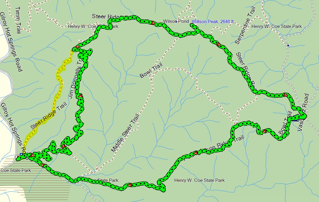
There are three rather steep trails to the top - Steer Ridge, Middle Steer Ridge and Lyman-Willson. My customary route was to take the very steep Steer Ridge trail up, and come back down Lyman-Willson, often with a detour to Willson Camp, using the Bowl Trail to return.
There has always been another well marked trail junction for the Jim Donnelly Trail, from Steer Ridge at a point about 1/2 mile below the Spike Jones Trail. It supposedly joined to Middle Steer Ridge near the bottom. If you took it coming down, you quickly discovered that it became indistinct and very hard to follow after a while, and you would probably wind up bushwhacking your way down the last part to get to the bottom.
In 2012, the Jim Donnelly Trail was rebuilt and resectioned to come out directly on Hunting Hollow Road shortly beyond the park entrance. In April, 2015, accompanied by Todd Hayes, Tim Souza and Carl Hage, I finally got around to checking it out.
Bottom line - this adds about 2 miles to the loop up to Willson Peak, but replaces most of the brutal un-switchbacked grade on Steer Ridge Road with something quite reasonable, which switchbacks its way up to the lone tree and rock outcropping which marks the junction. You'll still have a section of steep climb left past Spike Jones to the seismograph station, but you avoid most of it. It makes Willson Peak accesible to to those put off by the steep climb up, though, unless you retrace, you will still have a steep descent. Coming down Middle Steer Ridge is probably 7.5 - 8.0 miles.
You can see the difference between following the new Jim Donnelly Trail up, and the highlighted climb up Steer Ridge. After going up to Willson Peak, we came down by continuing on Steer Ridge to Willson Camp, and cutting over on the Bowl Trail to descend via Lyman-Wilson Trail. I will be comparing this to a trip I made up here in 2014 doing approximately the same thing except for going up Steer Ridge.
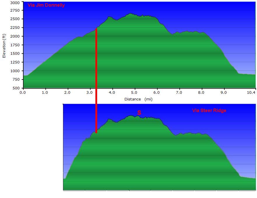
The Jim Donnelly trail adds about 2 miles to the loop, but makes the grade to reach the top much more reasonable, probably not over 10%, where the first mile of the Steer Ridge Trail probably averages near 20%. The sections following the junction point connected by the red line don't exactly match up mostly because of slight differences in the paths followed near Willson Peak at the top. Also, for the earlier hike I walked a short distance down the Serpentine Trail to scope out the valley (marked at "S").