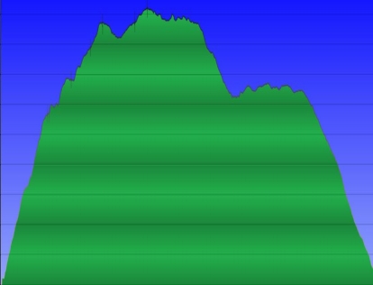
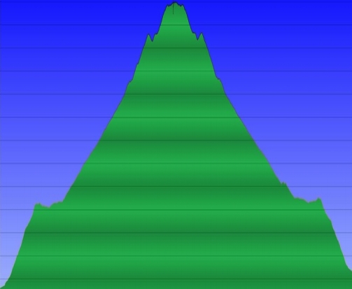
Hunting Hollow entrance, up Steer Ridge Road, down via Willson Camp / Bowl Trail / Lyman Willson. Flat final mile along Hunting Hollow Road chopped off.
Steep bit - 1750 feet in 2.2 miles.
| 1 | 2 | 3 | 4 | 5 | 6 | 7 | 8 | 9 |
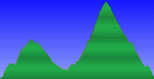
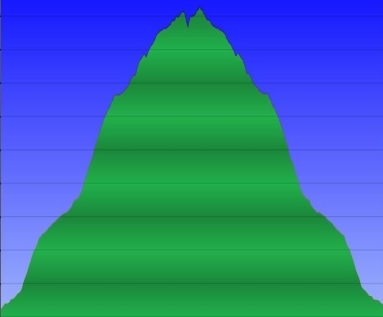
South Rim and Boccardo Loop. Approach from parking lot trimmed off.
Steep bit - 1000 feet in 1.5 miles.
| 1 | 2 | 3 | 4 | 5 | 6 | 7 | 8 | 9 |
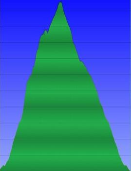
From Lexington Reservoir, Priest Rock trailhead, return via Limekiln trail to rejoin Priest Rock.
Steep bit - 1000 feet in 1.4 miles.
| 1 | 2 | 3 | 4 | 5 | 6 | 7 | 8 | 9 |
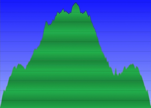
Up Portola Trail to Butano Loop Ridge Trail, back via Pomponio Trail. First quarter mile not shown.
Steep bit - 1250 feet in 1.9 miles.
| 1 | 2 | 3 | 4 | 5 | 6 | 7 | 8 | 9 |
From Rhus Ridge. Some altimeter drift is evident - this should be symettric.
Steep bits at beginning and near top, with fairly constant grade in the middle.
| 1 | 2 | 3 | 4 | 5 | 6 | 7 | 8 | 9 |
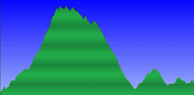
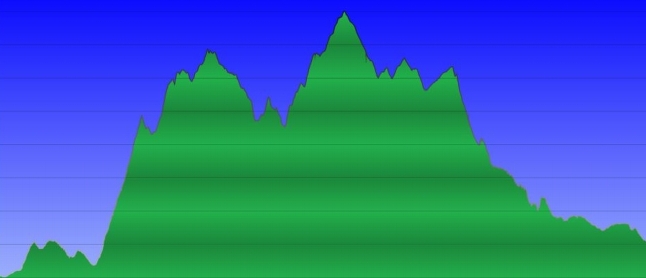
Clark Connector / westridge trail / Chalks road / Down to falls. 4 miles out to Waddell beach at the end chopped off.
Steep bits - Clark Connector, 900 feet in 0.9 mi. Westridge has several short sections of very steep grade, which you lose and regain a lot.
| 1 | 2 | 3 | 4 | 5 | 6 | 7 | 8 | 9 |
Up fire road from Highway 1
Steep bit - 600 feet in 0.5 miles, with similar pitch near start.
| 1 | 2 | 3 | 4 | 5 | 6 | 7 | 8 | 9 |
Up Peak Meadow / Horse Heaven from Stanford Avenue, down the heavily travelled fire road.
Steep bit - Horse Heaven, 1300 feet in 1.4 miles, particularly the initial part - 500 feet in 0.3 miles.
| 1 | 2 | 3 | 4 | 5 | 6 | 7 | 8 | 9 |