
Example: Dutch Flat (Joseph Grant) (brought up in separate window, toggle back to this one for reference if you like).
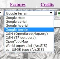
The map is initially brought up with "Google terrain" shown. This list is actually much smaller than the total list GPS Visualizer makes available. Currently, we don't need topo maps of Europe or nautical charts (we've waded a few times but it hasn't got THAT serious).
Often, the OpenStreetMap maps have some advantages over the other choices, although in other cases, they may be totally missing data for the park you are looking at. When they DO have it, they tend to be more complete and up to date, showing non-official trails as well as the ones from the park map, and picking up trail reroutes others don't show yet. OSM is crowdsourced from submitted GPS tracks.
Currently, the "OSM TF" maps display an "API Key Required" warning on top of the map. I've noted that the same thing happens when you display a track on GPS Visualizer's pages, so it may be their problem. You can use the map anyway.
The little streetview guy appears in the upper left corner of the map, when using "Google" map types:

Drag him to a spot outlined in blue, which may include the trails, and bring up interactive streetview with the Google provided controls for navigation and viewing:
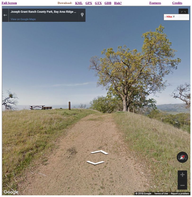
Sometimes you may see the shadow of somebody carting the streetview camera on their back. Get back out of streetview by clicking the back arrow in the upper left.
You may find "Google map" easier to see the streetview markings on than the default "Google terrain" choice.

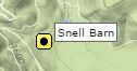
The starting/endpoint pin is yellow if it marks the beginning and end, or green and red if they are separate. More markers could get added if I like.
The "hamburger button" menu lets you see an "About" item and bring up the distance/area tool which you can also get by clicking on it in the bottom left. Currently, it also has a couple of items which aren't of much use. I should ptobably modify the script to remove them.
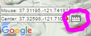
Follow the directions on the dialog it brings up. The tool is nice in that it provides clickable center points on the line segments it draws, allowing you to refine the path or shape.
You will also note that it displays the latitude and longitude of the current mouse position and the map center.